
 Creative director of ROA Patrick Stengbye talking about the shoes he chooses for running, what the brand will surprise us with in 2024 and President Zelensky’s style


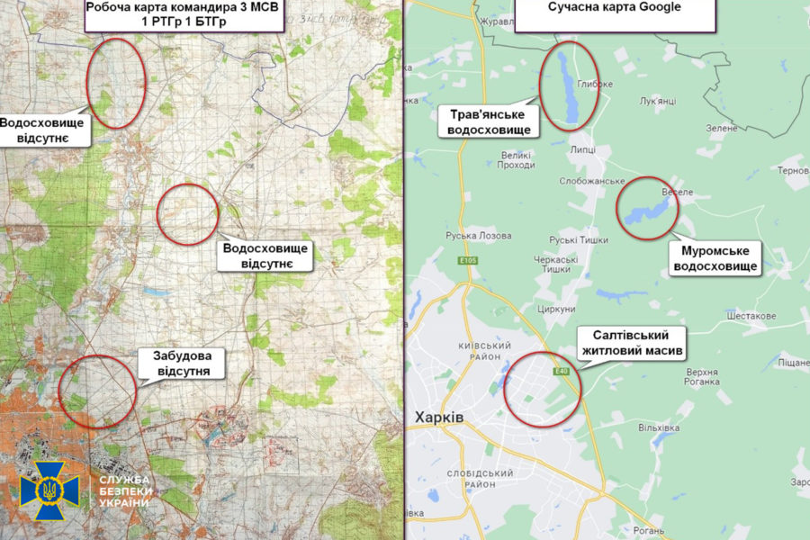
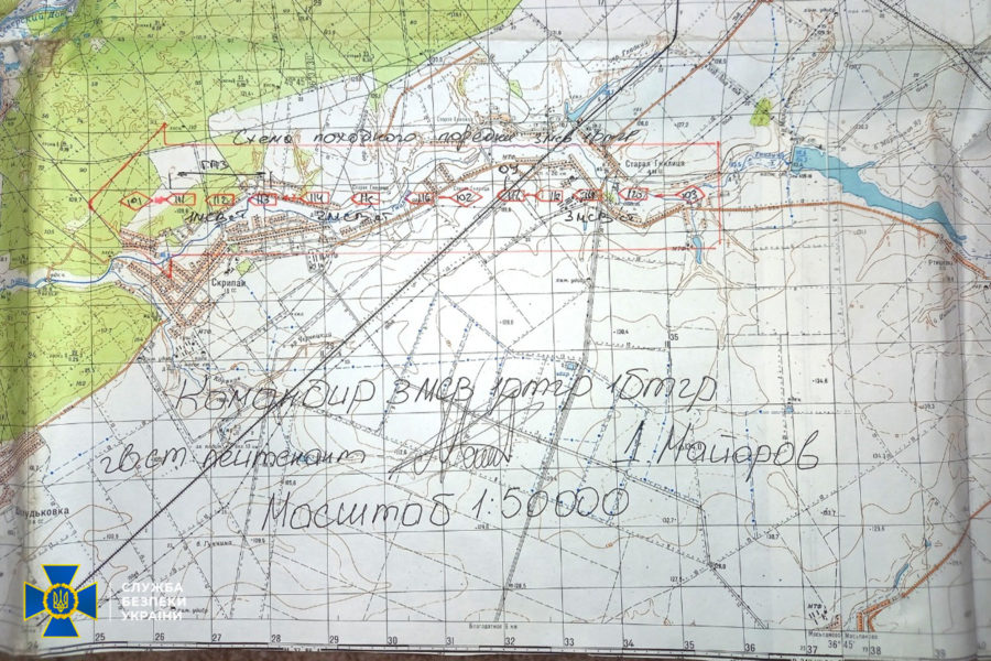
The Security Service of Ukraine seized the documents of the Russian invaders in Kharkiv region. They testify that Russian commanders use topographical maps of Ukraine issued in 1969.
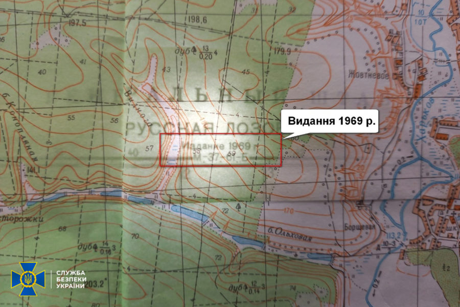
The maps do not show the objects and residential areas that have been constructed since 1969.
Even big water reservoirs built in the 1970s are not shown in these maps.
The state border between Ukraine and Russia is drawn with a pen.
Nevertheless, the maps have the mark ’classified information’ on them.
